
Annual Meetings & Maps
Conservation Strategies Committee
The Conservation Strategies Committee’s mission is to coordinate and cooperate on land conservation efforts between public agencies, conservation groups, land trusts, and private landowners in ways that will conserve and enhance the natural resources and rural way of life in the Blackfoot watershed. The committee provides a forum for exchanging information on conservation work being done in the Blackfoot watershed in which participants work together to identify priority conservation opportunities, look for ways to pool resources, and leverage one another’s efforts. Currently the committee meets two to three times per year. If you are interested in participating in this forum, please contact our Science Director Molly McDevitt.
Watershed Map
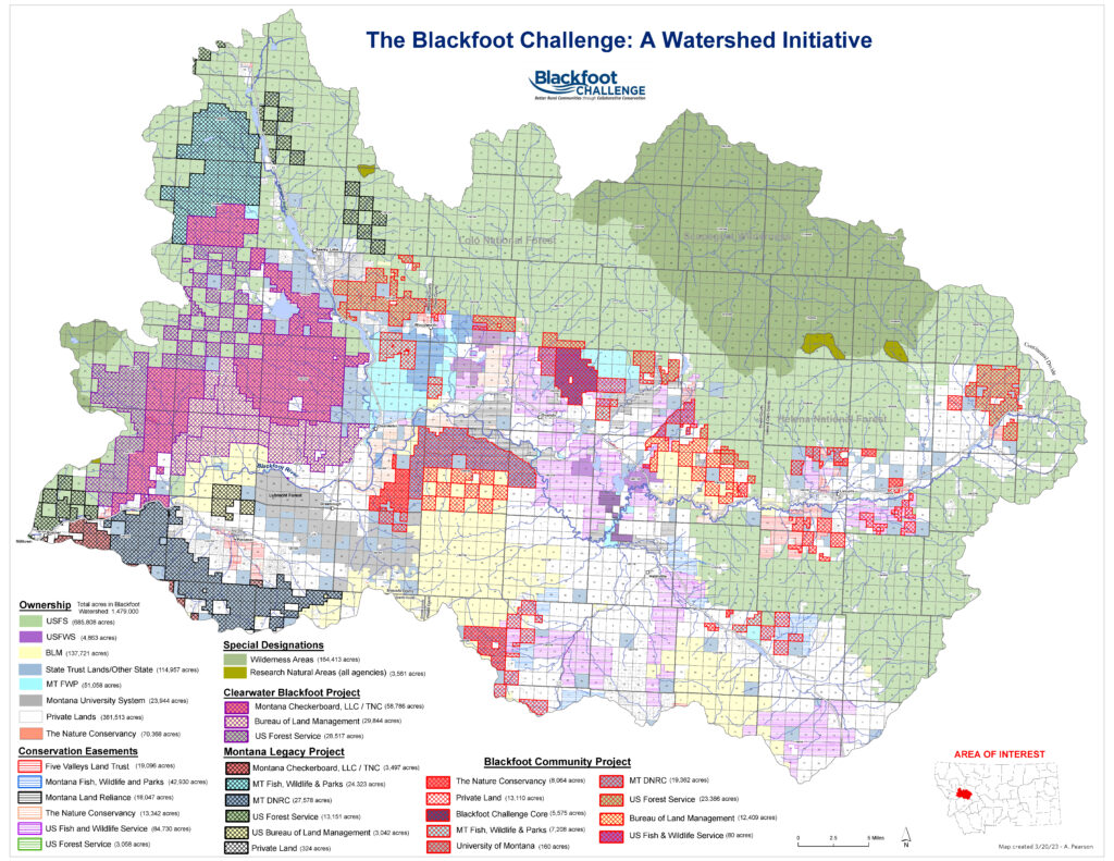
With assistance from The Nature Conservancy in Montana, the Challenge maintains an up-to-date land ownership and conservation easement map of the Blackfoot watershed. This map offers a useful tool for conservation practitioners collaborating on conservation planning for the watershed. The Blackfoot Challenge Science Program and parters are also developing a multi-layered conservation mapping tool that will incorporate resource conditions and priorities with the ownership layers to highlight areas of high conservation value where future stewardship and conservation investments will have the biggest impact. Download your own high-resolution copy here.
Blackfoot Subbasin Plan
From 2007 to 2009, numerous Conservation Strategies Committee members developed a plan that detailed a comprehensive strategy for conserving, restoring, and enhancing the natural resources and rural way of life in the Blackfoot watershed. This Subbasin Plan prioritized conservation strategies across the watershed with a focus on native salmonids, forestry, range and native grasslands, riparian areas, wetlands, native wildlife, and rural livelihoods. Take a look at the Subbasin Plan here.